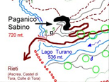
We are inside the Nature Reserve of Mount Navegna and Monte Cervia. From Paganico we reach the summit from three ancient paths:
A) "Scaluni"From the Municipal Sport Hall, after about 100 meters take left up to the Pineta. The path cuts across the pine forest behind it, until you reach the steep western slope of the mountain. Going on you'll reach the place called "Scaluni" where you can enjoy panoramic views over Lake Turano. The path culminates near the ridge of Cervia, the massif called Occalubberu. From there you can reach the top going up the ridge heading southward.
B) "Jovetu - Ovito (see registration form Ovito Route)
C) "Lobbera"From the village of "San Giorgio" along Via Monte Cervia, take a dirt road built in the '80s to arrive at "Lobbera" (900 mt. ) Almost at the end of the dirt road, after a marked curve on the left, the road becomes flat and before a lay-by there is a sign that indicates the rejoining with the old path that leads to "Caocese" (1000 mt. ). Here,in the 50s, the town of Paganico created basins to collect rainwater, and springs, as spring water lacked at high altitude. The stretch of road described above can also be followed through the old path from the sporting area, along the pine forest, until you reach "Lobbera" (a few tens of meters above the dirt path), although in some places, unfortunately, is still almost completely blocked. From the village of "Lobbera" to the village of "Caocese" the path crosses a hill covered with broom before entering the forest and divert to the north-west. At the end of this section you're out of the woods and you come under a huge tank to collect rainwater, the reactivation of which is under study. From here you can go two ways for the top of the Cervia.
C1) The Pratarella - From the tank you can take a northwest path that cuts across, slightly uphill, the slope of the mountain until you come close to "Occalubbero, " where there is a wide panoramic view of Lake Turano. From here you climb to the crest, and along the same road heading southward you'll reach the "summit ".
C2) Val Cupa - From the tank you can take a path heading southward which, penetrating inside Cupa Valley and going through the woods, then comes out below the summit, to which you climb up a steep slope, shorter but more difficult than the first one.

THE PEAK:
From the panoramic peak you can see the Terminillo, Gran Sasso, Velino and the surrounding area with the view of some medieval villages perched on rocky cliffs or perched in the woods (on particularly bright days, we can grasp the reflections of the "Dome" and the carriages of the train from Rome to Florence).
|


